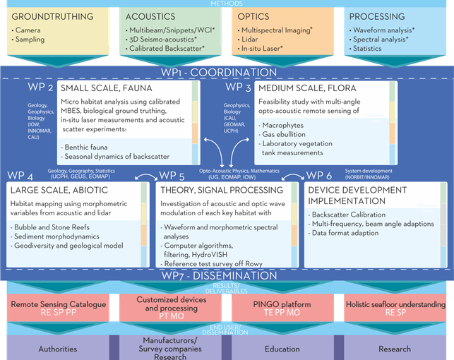
The project consists of 7 Workpackages (WP):
WP 1: Coordination
WP 2: Small scale habitats: Impact of small scale fauna in roughness and acoustic scatter strenght
WP 3: Medium scale habitats: Remote Sensing of benthic flora
WP 4: In-sity remote sensing of geodiversity for habitat mapping
WP 5: SIGNAL PROCESSING AND SEAFLOOR CLASSIFICATION
WP 6: Device development and implementation
WP 7: Dissemination
The Polish team is responsible for WP 5 which consists of all activities related to echosounder and LIDAR data processing, and classification of the seafloor habitats.
The main objectives are:
- Efficient processing and reliable algorithms for extraction of highly dimensional dataset
- Generation of habitat specific indicator variables
- Validation of calibrated echosounders and algorithms at reference test sites
The research tasks are:
Task 5.1: Spectral, wavelet, and statistical analyses of geomorphology of Digital Elevation Model (DEM) constructed on basis of opto-acoustics
Task 5.2: Model consultation and validation of calibrated sounders and LiDAR classifiers
Task 5.3: Signal processing methods of optical and acoustical data to extract additional information from the seabed surface, from volume backscattering of the shallow sub-bottom, and from backscatter signals in the water column by vegetation

